Short Courses
Practical short courses in Land Surveying & Geo-Information Technology
The Available Short Courses
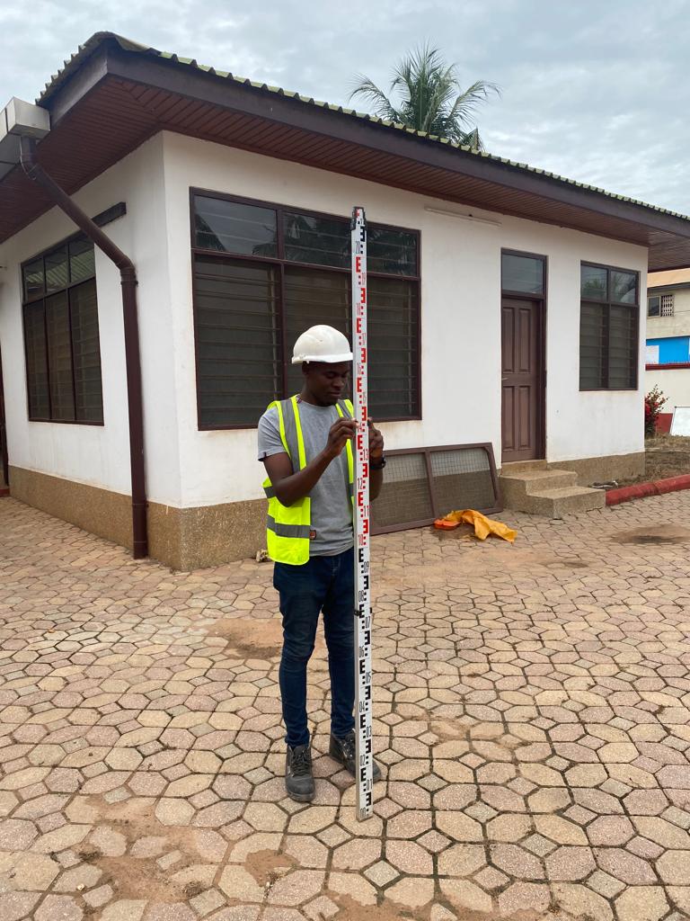
Surveying & Setting out – Levelling
Course Details
This course is aimed at students with little or no previous experience in using leveling equipment.
The course includes the observing, calculation and checking of levelling runs using the ‘Height of Collimation’ method of booking as well as checking the equipment.
Field practical exercises are used to back up the theory learned in the classroom.
An automatic optical level, manually booked is used for all exercises.
A basic knowledge of the use of calculators for addition/subtraction, multiplication/division and square roots prior to coming on the course would be an advantage.
Topics to Cover
- Introduction to Health and Safety (when using a level & staff)
- Background to leveling and leveling theory
- Reading the staff and booking the readings
- Sources of error in leveling and acceptable closures
- Two peg test and adjustment of the instrument
- Use of Intermediate sights & Inverted readings
- Practical field leveling exercise practical covering topo detail leveling
- Using Benchmark
- Establishing a datum
- Settling out levels for profiles
- Rise and fall booking
- Use of digital levels
At the end of the course students receive a certificate of attendance/completion skills.
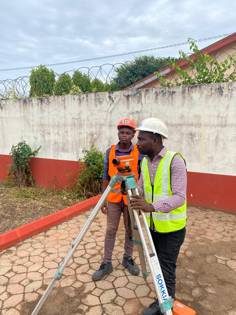
Surveying & Setting out –Total Stations
Course Details
The course covers best practice in the use of total stations for both basic detail surveying and setting out and is applicable to candidates working in either the surveying or the construction industries. Practical exercises back up the theory learned in the classroom. The Total Station will be used to measure angles and distances, also to store measurements and co-ordinates to be downloaded to a computer for mapping, and checking against required measurements. The course is taught with a Manual (Non Robotic) instrument, to give students confidence in accurate pointing. Hand calculations are kept to a minimum, but a knowledge of mathematics and the use of the scientific calculator prior to coming on the course would be an advantage.
Topics to Cover
- Introduction to Health & Safety (Using a total station)
- Horizontal and vertical angles Total station
- Total station – distance measurement theory
- Total station – setting up and using the instrument and Targe
- Practical field exercise familiarising with the Total Station
- Menu system – creating a job – entering co-ordinates
- Slope, horizontal distances and Height Difference Reduction
- Prism constants and atmospheric settings and Non Prism reflector less measurements
- Introduction to co-ordinates and how to stablish a new station from a base l
- Using known stations, and back sights, for orientation,
- Observing, downloading and plotting of field surveyed points – Field exercise
- Resection and free-station Programs
- Menu system – setting out
- Field practice setting out by co-ordinates
- Menu system – overview of other functions (such as reference line, remote height, tie distance and area.)
At the end of the course students receive a certificate of attendance/completion.
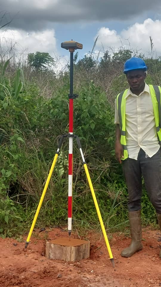
GNSS FOR SURVEYING AND SETTING OUT
This course covers detailed use of GNSS Survey equipment for land survey and setting out. Practical exercises back up by the theory learned in the classroom.
The GNSS equipment will be used to obtain coordinates of point as in static surveying and Real Time Kinematic applications. Basically, the GNSS equipment will be used for surveying for cadastral and topographical data, as well as for transferring surveying data to the field as in setting out of in construction. There will be detailed use of data loggers and softwares.
Topics to Cover
- Introduction and health & safety (when using a GNSS)
- GNSS segments
- GNSS signals
- GNSS positioning methods
- GNSS error sources
- GNSS satellite constellation
- Introduction to coordinates & coordinate systems
- Problems of using GNSS in Ghana
- GNSS (RTK) base station setup
- DGPS – post-processing of static data
- Points survey with GNSS
- Setting out of points using GPS
- 3D points measurement (topographic survey) using GNSS
- Downloading and plotting of field surveyed points (RTK)
AutoCAD for Surveying
This course is specifically aimed at new and current AutoCAD users in the Land Surveying
Topics to Cover
- Understand AutoCAD Environment & how to use the toolbar.
- Project set-up and templates
- Layer Management, Inserting Drawing, Blocks
- Annotation & viewport scale
- Understanding UCS and Coordinate system
- Control line visibility
- Topography digitisation from dxf
- Scale & grid rotations
- Finding measurements – area and distances
- Methods for converting paper drawings to AutoCAD.
- Importing and working with Raster Images
- Turning off the frame, adjusting quality, and controlling transparency
- Importing a PDF file
- Scaling & Osnaps with PDFs
- Controlling a PDF display
- Importing a PDF as an AutoCAD drawing
- Reconstructing imported SHX fonts
- Sheet Layout and Title Blocks
- Scaling & adding a scale bar
- Exporting and printing – to PDF, plotter etc.
CERTIFICATE/ COMPLETION: At the end of each course, trainees will receive a certificate of attendance/completion
Take a glance!


Application Form
Click the button below to download the application form.